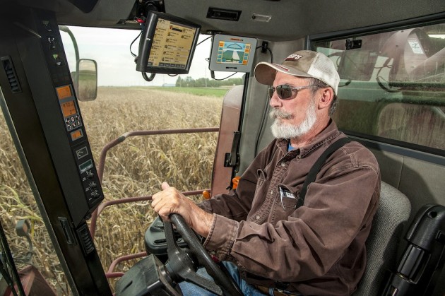
 This image shows farmer Roy Bardole seated at the controls of his combine in a cornfield on a farm in Iowa. A GPS guidance system display is mounted at the top center on right side of the tractor cab. Satellite navigation helps farmers meet the challenge of increasing crop yields and lowering costs. They can use precise positioning to plant and harvest faster and more efficiently than ever before. And by applying fertilizers and pesticides more precisely, they can reduce the environmental impact of raising crops. Click the exhibition title below to see more from the new National Air and Space Museum show “Time and Navigation: The Untold Story of Getting from Here to There.”
Snapshot


